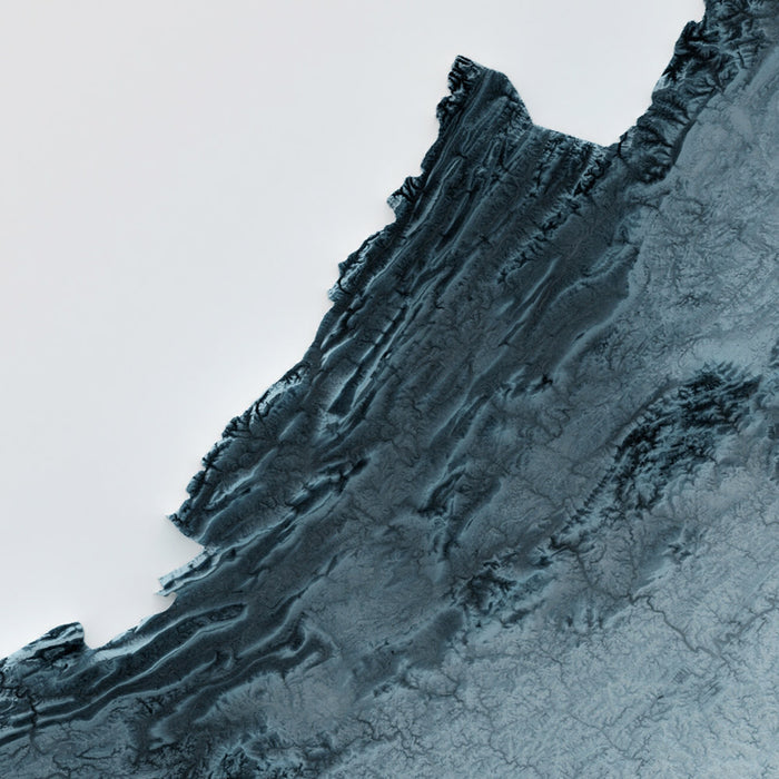
Virginia Topographic 3D Relief Map
Virginia Topographic 3D Relief Map


Couldn't load pickup availability

Virginia Topographic 3D Relief Map
🔒 Order with Confidence
🔒 Order with Confidence
✅30-Day Money Back Guarantee — no risk trying it.
🚚Free shipping available. Orders processed within 24–48 hours.
🔐Secure & encrypted checkout with trusted payment providers.
Celebrate the rich and varied landscape of Virginia, United States of America, with this detailed 3D relief map. Virginia’s iconic geography unfolds in dramatic textures—from the rugged summits of the Blue Ridge Mountains, where peaks rise steeply and catch the light, to the rolling ridges and deep folds of the Appalachian Plateau. Subtle shading reveals the sharp relief of mountain hollows, highlighting the patchwork of valleys and forested slopes that define western Virginia.
Eastern Virginia transitions into the gently undulating Piedmont, a landscape of low hills and wide basins, where the relief softens and the play of light brings out the meandering courses of ancient rivers. Moving further east, the land flattens into the Coastal Plain, etched with the winding tributaries and wide estuaries of the Chesapeake Bay—each subtle shadow reflecting the region's expansive wetlands and tidal inlets.
This map captures the full sweep of Virginia’s terrain in striking dimension: from the highland crests that form the backbone of the state, through dramatic escarpments and fertile valleys, to the open plains and intricate river deltas that reach the Atlantic shore. Every ridge and hollow, every river-carved gorge and broad plain, is carefully modeled so you can appreciate Virginia’s natural beauty from a new perspective.
Perfect for anyone who calls Virginia home, cherishes memories of its storied landscapes, or wants to give a meaningful gift that celebrates this legendary state.
Please note: While this map looks very 3D, it is a 2D map, printed in two dimensions on paper or canvas.
About our Unique 3D Topographic Relief Maps
These aren’t just maps — they’re landscapes, sculpted with light and shadow.
Our shaded relief prints use ultra high resolution topographic data and a secret 3D rendering process to create the illusion of raised terrain — like the mountains are about to lift right off the page. No labels, no borders, no distractions. Just the raw shape of the land, brought to life in a clean, modern style.
They’re designed to feel timeless. Bold enough to be a centrepiece, subtle enough to blend in. A perfect gift for map lovers, mountain wanderers, or anyone who finds beauty in the shape of the Earth.
And of course, like any of our other maps, you can personalise this topographical map as well. Why not mark your favourite peaks, or the routes of your favourite hikes and cycle rides?
More Product Info
If you're not sure what size to order, or you're looking for a custom order of some kind – a different size, a different colour, a special frame – then please contact me. I usually respond within a few minutes.
You can see an example of my map personalisation service in the fifth image. Zoom in and take a look. My personalised maps are always very well received. Take a look at more examples of personalisation.
You can also choose to age your map to make it look older. This is popular amongst my customers who want their artwork to look like an older, antique print. You can see an example of ageing in the sixth product image, or go ahead and check out lots of examples of other aged artwork.
The model in the listing images is holding the 18x24in (45x60cm) version of this map.
I can print and frame this beautiful topographical 3D map at sizes up to 3 metres (10ft). If you are looking for a size or framing option that isn't available online, please get in touch.
This map is available as a giclée print on acid free archival matte paper, or you can buy it framed. My standard frames come in six colours (black, dark brown, dark grey, antique gold, oak and white), and custom framing is available for an additional charge. My frames are glazed with super-clear museum-grade acrylic (perspex/acrylite), which is significantly less reflective than glass, safer, and will always arrive in perfect condition.